

Chase 2009
Target: Oklahoma City, Oklahoma
Leaving Topeka, KS around 10:30 am I drove south on Interstate 35 and noticed some elevated convection just south of the Oklahoma/Kansas state line. Looking at radar it seemed as though the convection was forming along the northward moving warm front. I got a call from another chaser, Scott Blair and he notified me that a Supercell had formed just southeast of Oklahoma City. The supercell and I were moving in opposite directions, so I had to accurately gauge where and when the storm would cross the freeway. Upon reaching Guthrie, OK I had to stop for gas. At the gas station I saw the front flank of the approaching supercell which had spawned the tornado and did damage to the northwest suburb of Oklahoma City. As I was filling the tank I was able to get my first good look at the storm moving toward me. After some deliberation I decided to get back on the Interstate and go southward until I was south of the storm. As I was speeding south I could see the clouds clearing up, indicating I was out of the forward flank of the supercell. At this point I was a little relieved. To my right, just west of the freeway I could see multiple choppers hovering around the tornado which had moved out of the OKC area and was doing damage in Edmond, OK. I exited on Covell Blvd. in Edmond and found a collection of chasers and spectators. I looked north, but could not see more than rain and clouds. By this point the tornado probably dissipated, or at the very least was rain wrapped. There were 2 more supercells moving northeast behind the supercell that I was currently near. I reached the northwestern portion of OKC only to find that the supercell I was stalking had dissipated and lost its definition. The Weather Channel called me and asked for a visual of what was going on. I had very little information to give given the ground obstructions. I decided to go further west and subsequently crossed the path of the first tornado, indicated by strewn about trees and plants. With the daylight eroding and storms winding down I decided to head home for the evening. On my return I stopped back in Guthrie and saw that the town was socked in with very dense hail fog. The original storm moved through the area around 3:00 pm, and it was now 6:00 pm. The hail on the ground was still very large, around half dollar sized. I finished the trip by driving north on Interstate 35 and observed impressive anvil crawling lightning.
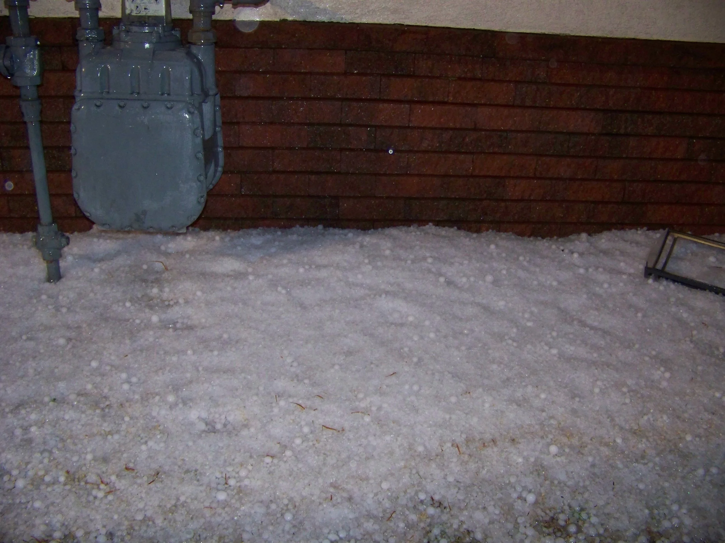
Back in Guthrie, this hail had been on the ground for well over 3 hours. Some of these stones were still golfball sized, or larger. Dense hail fog was also experienced due to the large volume of ice on the ground.
Target: Southeast Kansas
Leaving Lawrence, KS around 4:30 pm, we ventured on a short chase down to southeastern Kansas. Potential for high impact severe weather was low, but since its proximity was so close, we figured it would be a good day to get out and see some storms. We traveled southward on highway 59 out of Lawrence through Ottawa and Garnett until we encountered some high based thunderstorms. Sunlight was already starting to fade, so the chase was called off. Before we started for home we took a few photos of a picturesque sunset with the elevated storms in the foreground. This chase demonstrated to us that you do not have to intercept high impact severe weather to have a great outing and capture great photographs.
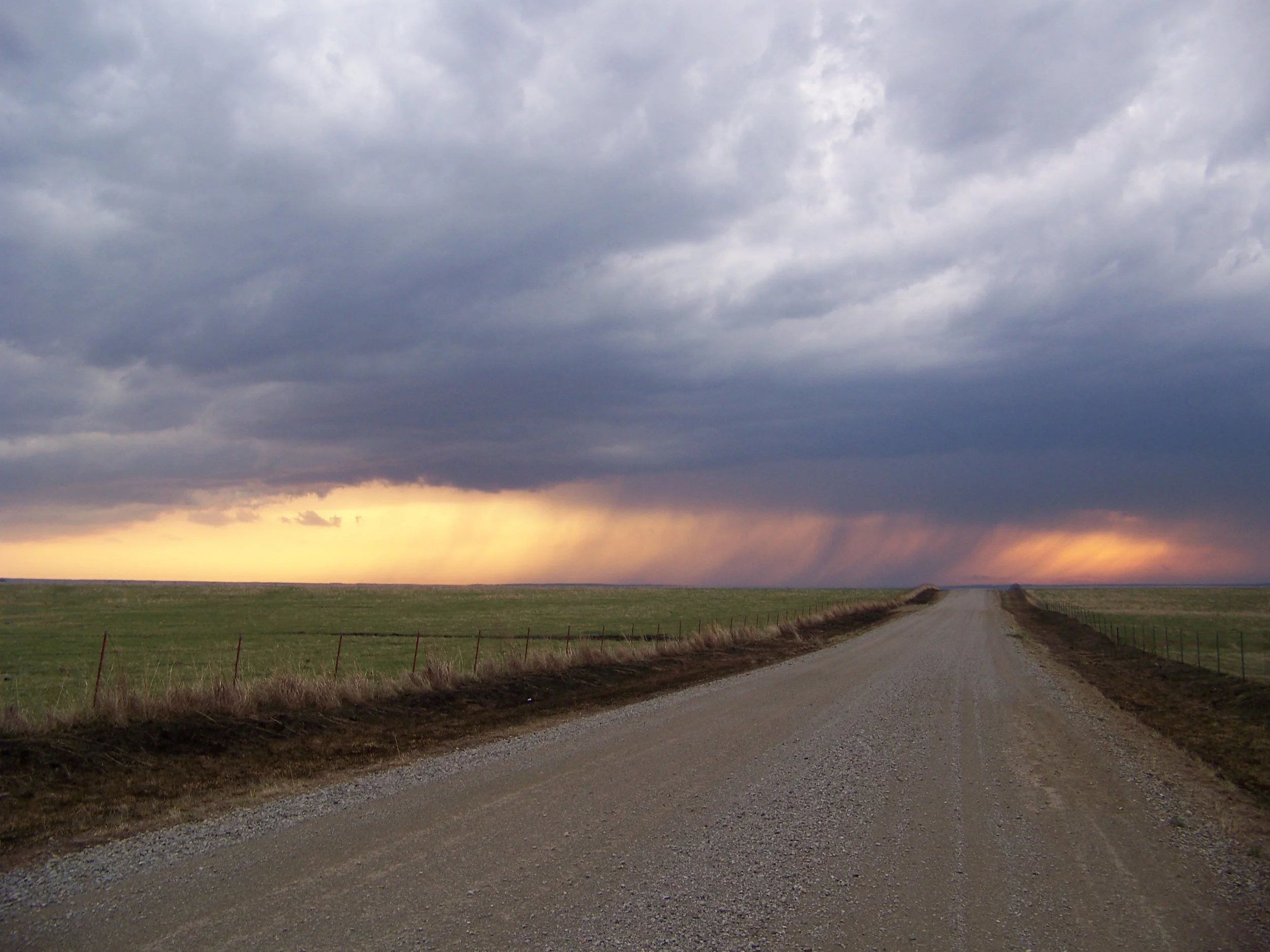
Looking to the west, the rain shaft from the elevated storms created a beautiful foreground to the sunset.
Target: Clinton, Oklahoma
This day featured "the chaser's worst nightmare." After forecasting severe storms and supercells across western and north central Oklahoma, I set out from Topeka, KS to Woodward, OK before repositioning to Clinton, OK. While waiting for convection to initiate in western Oklahoma, I took a glance at ktwx radar (Topeka) only to see a tornadic warned supercell move over the city of Lawrence. Eventually it spawned a tornado in Wyandotte county, northeast of Lawrence. Back in western Oklahoma convection initiated around 4 pm, and the storms quickly morphed into supercells dropping copious amounts of large hail. Although tornadoes occurred in the area that day, I did not witness any of them. Numerous funnel clouds were observed, but none ever reached the ground. To finish the chase I dropped south to Cordell and Corn, and followed a supercell northeastward. This last chase occurred at night, and limited storm structure was noted. Once I made it back to Interstate 40, I headed eastward back to Oklahoma City, then north on Interstate 35 to Topeka.
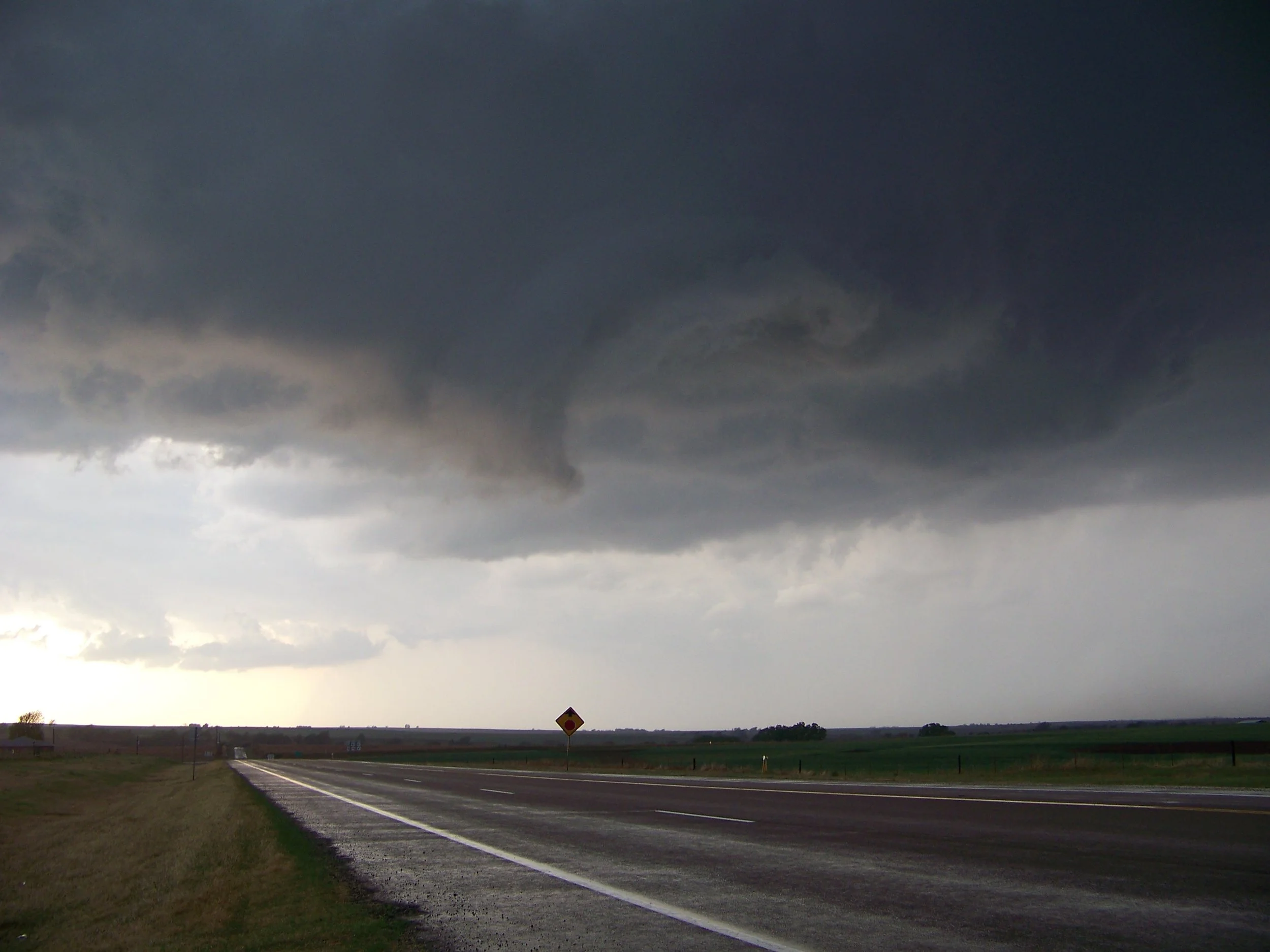
Broad circulation overhead
Target: Dodge City, Kansas
This chase will most likely go down as one of my most memorable chases. As a new chaser, I hadn't much success finding good storms nor capturing good photos. The storm that I caught near Garden City, KS changed all that.
We left Topeka, KS around 2:00 pm and targeted Dodge City, Kansas. Storms initiated in southwest Kansas as we were going through Great Bend. By the time we were in range to see the storm it had already taken on supercell characteristics. Being east of the storm we captured great photos of the storm's mammatus clouds. As we approached Garden City we dropped south, since we noticed the storm took a hard right turn and was now moving south. The hardened and striated structure of the storm was absolutely amazing. And since the storm had a relatively slow storm motion we were able to keep up with it easily and capture many photos.
Once the original supercell showed signs of weakening, our attention quickly focused to the south where a new updraft was starting. This new updraft quickly morphed into another supercell and cut off our northeast route. Since light was quickly eroding we decided to head home, but this new storm sat nearly stationary over our route home. Reports of softball sized hail littered the spotter network, so we sat near Sublette for about 30 minutes until the second storm finally showed signs of weakening. As we traveled back to Sublette we encountered very dense hail fog. We pulled over to find a field full of softball and larger sized hail. After taking some photographs of the large hail we finished the chase and left for home.

The supercell sat nearly stationary for several minutes over the fields of southwestern Kansas, south of Garden City.
Target: Dodge City, Kansas
The day started out in Topeka, KS, where we left at 2:00 pm and headed west along Interstate 70 toward Dodge City. I decided to stop in Junction City to decide whether to continue to Dodge City or turn back to El Dorado where surface winds were more out of the southeast. After careful deliberation we continued on our primary path toward Dodge City. By the time we got to Great Bend convection initiated just west of Dodge City. We decided to take a county road south in front of the storm with the intent of getting south of it. Before we reached Belpre, KS we started getting hit with nickel to quarter sized hail. Upon reaching Belpre we dodged under a gas station canopy and waited for the hail to stop. The hail continued to get larger until ultimately baseball sized hail fell (depicted in the above video captures). After the hail finished we decided to continue south and loop to the east to keep up with the supercell. As we exited the gas station we saw a rotating feature that looked very suspicious less than a mile south of the gas station. The lowest levels of the rotating feature were obscured by trees, so we cannot confirm a visual of a tornado. (Subsequent radar analysis indicates a tornado was indeed on the ground at that place and time). Instead of taking our chances with the possible tornado we decided to move back to the north and take our chances with the hail. About 3 miles to the north we encountered quarter to half dollar sized hail and 60 mph winds. Not wanting to lose the storm for good we decided to go back south through Belpre, and continue the chase. To get out of the convection we continued south through Belpre and aimed for Hwy 400. As we traveled through Trousdale we encountered some large trees laid across the road (potential tornado damage). In order to continue south we had to break a few branches off the tree so our Civic could drive THROUGH the tree. As we continued south we encountered severe winds, which LSRs later indicated were 70 mph or greater. We finally made it to Hwy 400 and began our trek eastward toward Wichita. Deciding to just end the chase, we drove east. Looking to the north we could see nothing except large dark clouds and a lot of moisture indicated by the deep bluish-green coloration of the clouds. We reached Wichita and as we got some food and gas we found ourselves in the path of another severe thunderstorm. This one only produced quarter sized hail and presented us no problems. As we headed home on the Kansas turnpike between Wichita and Topeka we encountered a very fast moving bow echo segment which brought very heavy rain and strong cross winds. Finally after a very exhausting chase which gave us baseball hail, 70 mph winds, and a couple tornadoes we reached home around 10:30 pm.