

Chase 2022
Target: Fort Dodge, Iowa
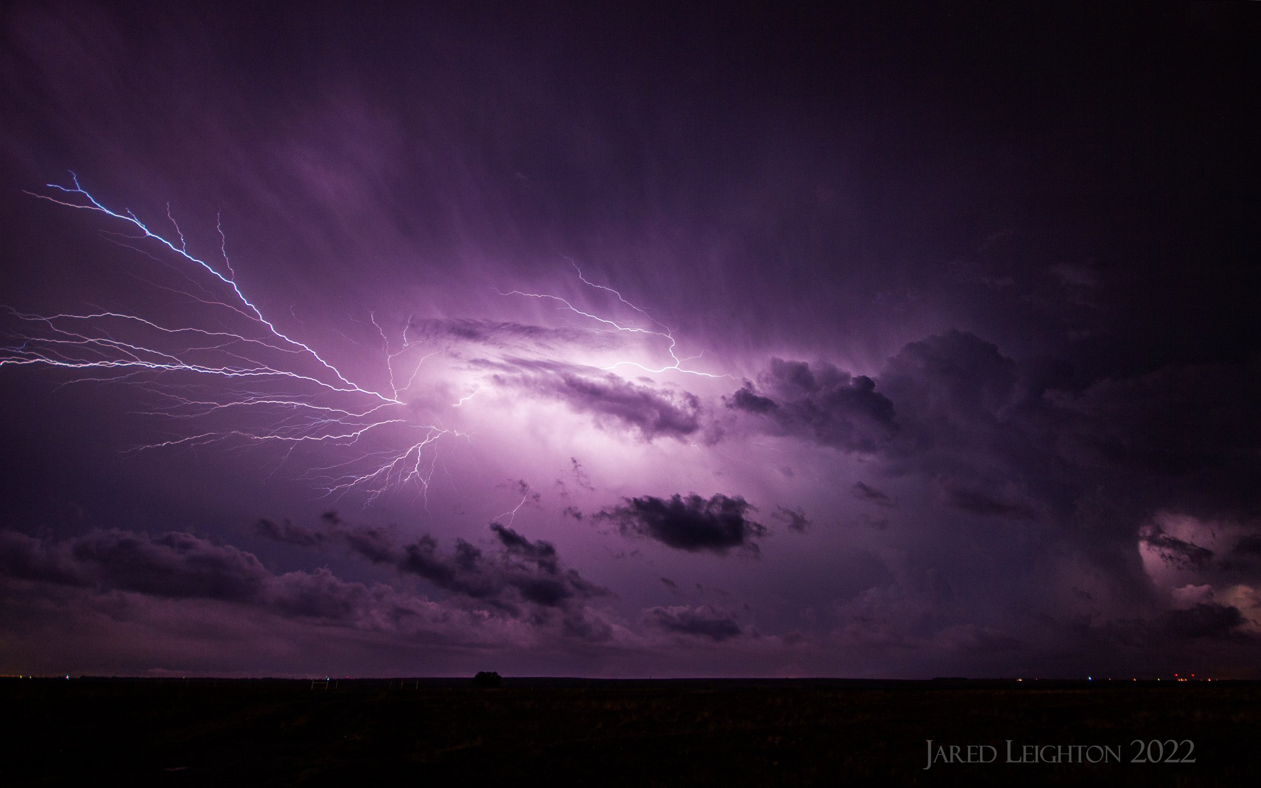
Left Kansas City with Scott Blair around 12:00 pm, heading north toward northern Iowa. The warm front for this set up was still around Kansas City when we left, but raced northward to the target area through the day. By the early to mid afternoon temperatures in the 70s and dew points around 60 to 65 had reached I-80 and points north of there. Initial storms developed along the warm front and rapidly developed into a multicellular supercell. Within a half hour, the first tornado was forming along the warm front, which caused us to target the Humboldt area. We witnessed the first tornado as it formed just southwest of Gilmore City. We raced toward Gilmore City along Highway 3 and watched the tornado cross the highway just to our west. As the wet RFD came around from the downstream mesocyclone, we pushed east-northeast through Rutland, toward Renwick and Lu Verne. Along Highway 17 we saw what could have been another tornado buried in the rain as the storm approached Livermore and Lu Verne. We led the storms northeast to around Britt, Iowa before it became too HP, and with rapidly fading light we cut the storm loose. We dropped south to Clarion to check out the storm moving north behind the lead supercell. This storm provided a nice lightning show, with some clean bolts. The most notable feature of this storm was the intense inflow, which at times approached or exceeded 60 mph. Dust from nearby fields made visibility difficult at times, and the constant wind made positioning difficult. Probably to this date, this storm exhibited the strongest inflow winds I have experienced.

Tornado crossing HWY 3, just east of Gilmore City, Iowa
Target: Herington, Kansas
Left Kansas City in the early afternoon, with the intent to play along the dryline in southern Kansas. The moderate risk was well to the north of our target area, but considering the potential for deep convection along the dryline opted to go to the Wichita area. Early initiation along the dryline was high based and emaciated, but anticipated this convection would get into a better environment as it advected northeast. The initial cell we followed into the Flint Hills ultimately dissipated, however the trailing cell quickly became the better cell as it approached I-70 at Junction City. We went west toward Chapman and dropped south on Highway 43 toward Enterprise. The storm as it traveled north, toward our location produced a funnel that caused some damage a few miles southeast of Enterprise. We hoped it would continue to produce tornadoes, but ultimately the storm became multicellular as it crossed I-70. Ensuing storms caused some damage across the Flint Hills, and of course Andover saw a very picturesque tornado this day.

Target: Clarendon, Texas
Left Kansas City with Scott Blair early in the morning on May 4, with the intent to play along a retreating warm front in northern Texas. The initial plan was to get to the Amarillo area, then with some mesoscale analysis find the warm front, anticipating tornadogenesis. As we approached Amarillo from the east an initial supercell had already formed, and was producing some hail just southwest of Amarillo. Seeing our environmental temperature was not favorable for this storm to survive, we dropped south toward Clarendon, where we awaited further initiation along the dryline. We did get another storm that formed and pushed northward toward the I-40 corridor, but like the previous storm that pushed into the cold air it did not survive long. The final storm of the day formed around Silverton, Texas and pushed eastward into the Memphis and Wellington area. Initially this storm had some promise, as the low and mid levels were rotating furiously. This rotation was evident as it overtook our position near Memphis, Texas. However, as with all the previous storms despite the promising structure it was too outflow dominant and the rotation we perceived was ultimately decoupled from the surface, meaning the storms had little chance to produce a tornado. We called off the chase as we approached the Texas/Oklahoma border near Wellington and headed home toward I-40. To our south, near Quanah, Texas a more formidable tornado formed, but we were too far north to intercept.
Target: Cottonwood Falls, Kansas
Scott Blair and I left Kansas City in the afternoon, with a clear dryline target in central Kansas. The chase ultimately we about as intuitively as possible, as the initial convection on the dryline formed into a skinny, but formidable supercell. We dropped south on Highway 77 from Florence, Kansas and watched the storm mature. As the storm crossed our highway over Florence, we drove through the RFD and any weak circulation caused by the surging wind. This offered a unique view of the chaotic rain bands associated with ground circulations caused by surging rear flank downdrafts. We led the storm eastward on Highway 50 toward Cottonwood Falls, then dropped south on Highway 177 a few miles, where we were able to see it briefly take on a very picturesque appearance. We led the storm back to Emporia, occasionally glancing back to see an outflow structure and ultimate demise of the storm. We briefly dropped south on I-35 toward Wichita, and as we passed the Cattle Pens we watched the southern (and to that point more promising) storm ultimately die. We retreated north to end the chase near Emporia.

Target: Marysville, Kansas
This was a unique chase and a unique perspective. Considering this to be a “local” chase I left Kansas City around 3:30 pm with the parents, and drove north to the St. Joseph area, anticipating mature supercells in the 5-7 pm range in southeast Nebraska or northeast Kansas. This did not play out, and the robust convection initiated more toward Grand Island and made slow progress my way. Taking this into account, instead of going further north we dashed west on Highway 36 through St. Joseph, Troy and Seneca. The storm we targeted kept turning right, and ultimately landed itself on a directly south trajectory, toward Marysville, Kansas. As we approached Marysville, we had a choice between taking Highway 99 south or Highway 177 south. We determined that Highway 177 was too far west, and decided to intercept the southward diving supercell as it crossed Highway 36. About 3 miles east of Marysville the storm produced a brief tornado deep in the rain, which was only visible from our position directly east of the storm. Viewers to the west or south of the storm were blocked by the heavy rain curtain that wrapped the mesocyclone up. Severe damage was done to Marysville, but it’s plausible that this damage occurred from strong RFD to the west of the southward moving storm, as opposed to the tornado that appeared to remain east of the city center. We got blasted with 60-70 mph RFD as the storm crossed Highway 36 so we retreated east toward Highway 99 and paralleled the storm southward toward Highway 24. To our east and well out of our way the storm continued to produce tornadoes, but we did not view any of them. We landed in Wamego and before abandoning the storm to go east toward Kansas City we remarked at the great, deep structure the storm took on as it moved into the Manhattan area.
