

Chase 2019
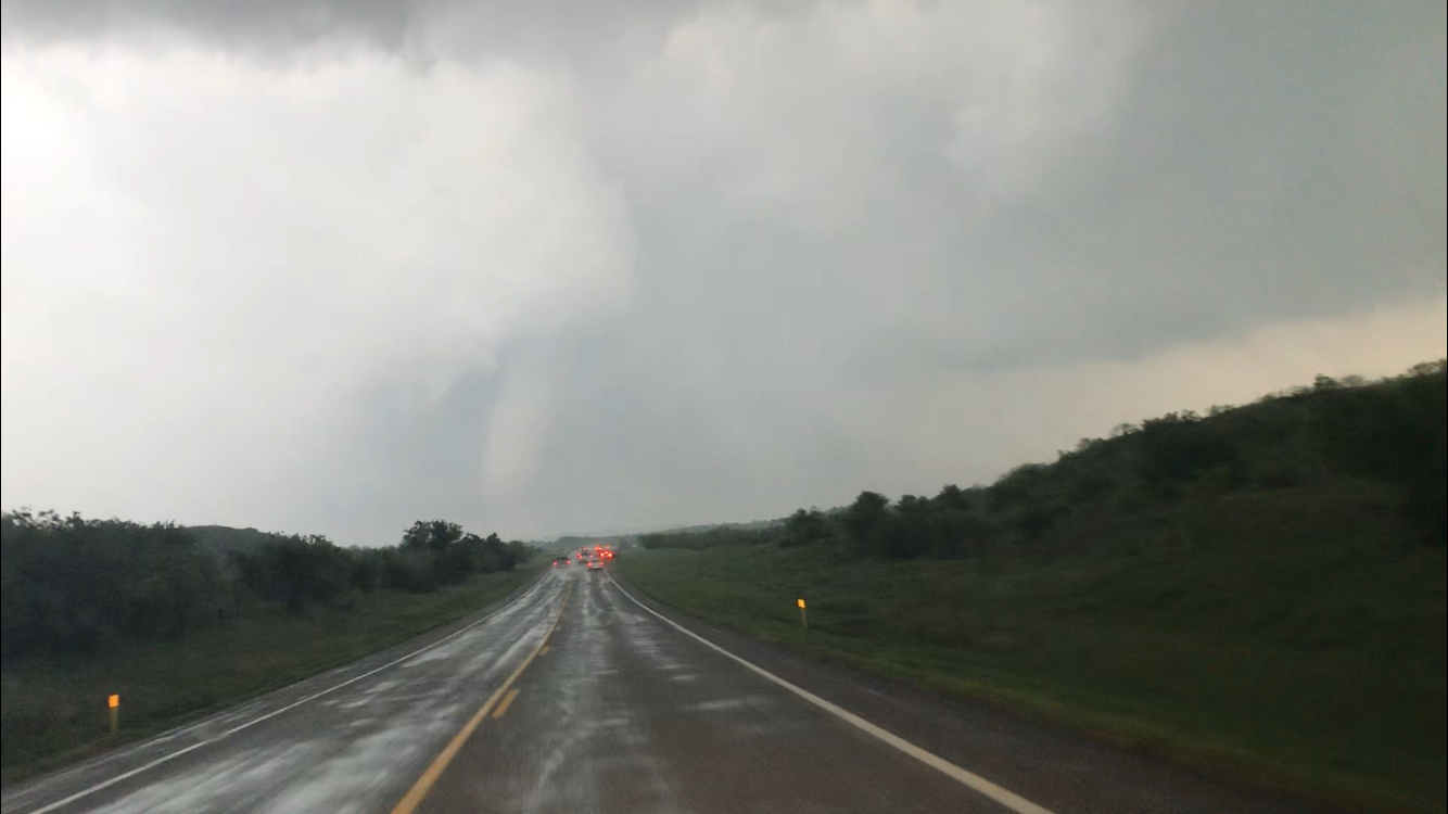
Target: McCook, Nebraska
Left Kansas City early on the morning of May 17 looking to intercept storms that were anticipated to form in northwest Kansas in the afternoon. As we approached Colby on I-70 the target became clear… McCook, Nebraska area as the storms were quickly moving north into far southwest Nebraska. We intercepted the storm of interest just west of McCook and watched it for about 20 minutes as it approached Highway 6 near Culberson, Nebraska. The complication of the chase was how to deal with the city of McCook. Anticipating a tough trip through McCook and wanting to keep up with the storm we opted to get east of McCook so the city traffic wouldn’t hold us up. As we cleared the city to the east we stopped at the armory near McCook airport. Here we watched it form a tornado just west of McCook - near where we were stopped prior to moving east. Once the tornado dissipated, we followed it northward along Road 396 toward Stockville. There was a surprise second tornado of the day that formed just outside of our window, just north of Highway 18, as we were going east toward Eustis. This tornado was brief, but did kick up quite a bit of dirt just north of the highway. Our final move on the storm was to move north on Road 408 toward Farnam. Along 408 it produced another very photogenic tornado that produced some EF-2 damage to the city. While trying to get through the damage, and going around rural roads we fell too far behind the storm. We followed it back to I-80, but by the time we reached the interstate it was well to our north, moving fast. We bagged it near Cozad and headed home.

Target: Hollis, Oklahoma
On a rare High Risk severe thunderstorm set up in the southern plains we drove southwest from Kansas City, aiming to get to southwest Oklahoma. The Wichita Mountains would be the staging area for supercells later that afternoon. In what ultimately turned into a high risk bust there was one storm that produced a tornado that damaged portions of Mangum, Oklahoma. As we tried to intercept the storm near East Duke, Oklahoma the chaser convergence in the area caused us to abort that approach, and instead move north toward Magnum. As we were heading north along Highway 34 we saw a low contract tornado as it impacted Mangum. This was the only intercept of the day and as we followed the storm northeast we ultimately came upon I-40 and headed home.
Target: Lawrence, Kansas
We spent the first few hours of the day in Cameron, Missouri monitoring the tight boundary located along the Highway 36 corridor. Heavy rain to the north of that boundary reinforced the cold air, so we dodged back to the southwest toward Lawrence to intercept a maturing supercell in that area. After getting slowed down by flooding in Platte County we finally reached the storm as it was moving just southeast of Lawrence toward Highway 10 in eastern Kansas. We sat near Eudora for about 10 minutes looking toward Lawrence, but as the storm approached we jogged a little south of Highway 10. This was a slight miscalculation as the storm was pushing north toward Linwood. We got behind it, so rushed eastward on Highway 10, then north on Highway 7. We reintercepted the storm just south of Bonner Springs along Highway 7. We were tempted to go across the Kansas River, but stopped just south of the river as it looked like the storm and mile-wide tornado would beat us to that spot. While we didn’t make visual contact with the tornado we did get hit with 80-100 mph RFD winds that nearly rolled the car into a nearby ditch. The winds subsided and we went home, leaving the storm to go on and produce at least one more tornado in Kearney, Missouri. The tornado that formed near Lawrence and tracked to Bonner Springs was rated EF-4.