

Chase 2015
Target: Joplin, Missouri
Left work around 3:30pm to drop south toward Joplin. This was an early season event, so expectations were low. But considering the proximity and lack of upcoming events, we decided to take the trip to Joplin. Upon arriving at Jopin storms still hadn't initiated, so we waited for about an hour, until the first towers went up near Independence, Kansas. With sunlight diminishing quickly we set up just west of Columbus to watch the HP storm roll by. Given the lack of usable roads and the trees/hills of the area we did not get many looks at the storm before darkness set in. Calling it a day, we got back to Joplin around 8:30pm with the intent to grab some food, but another supercell had become tornado-warned and was heading right for the city. Feeling uncomfortable about the situation we got on I-49 and headed north, away from the tornadic storm.
Target: Great Bend, Kansas
Left Pleasant Hill, Missouri around 2:30 pm with the intent to chase marginal storms in central Kansas. This was anticipated to be a low end day, but with CAPE approaching 2000 J/kg and deep layer shear approaching 50 kts it seemed likely that the storms would at the very least be organized and maybe even supercellular.
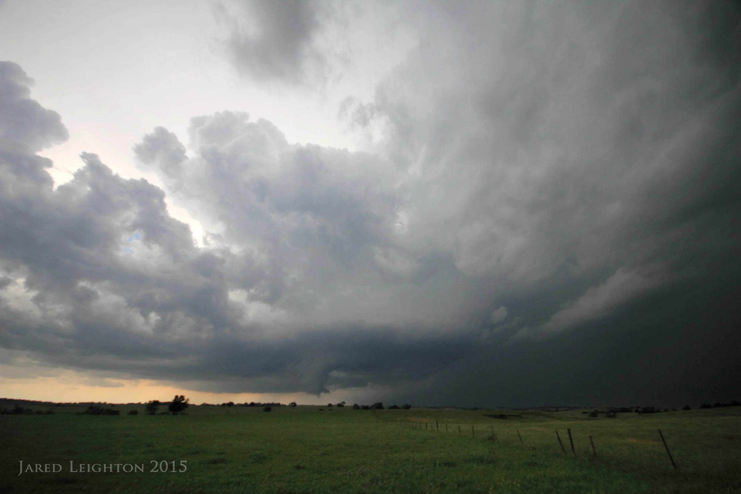
Throughout the trip west the mid and upper level clouds appeared bo be too much to overcome for the storms, but around 6:00 pm some weak convection went up near Dodge City. The original target was to stay along I-70 and play some convection in the better shear north or along I-70, but when the Dodge City storms went up the plan then became to get to Great Bend and play those storms. Discouragement set in when a storm near Smith Center, in my original target became supercellular. Since that storm was too far away I decided to escort the storms near Great Bend eastward to see if they would strengthen. Near sunset and near Lyons, Kansas the storm I was on briefly became organized and allowed for some good photography opportunities.
Quickly, to storm bowed out, leading to a shelf feature following me through McPherson, Hillsboro, and eventually Emporia. After grabbing a few lightning photos at the Hillsoboro grain silo I called the chase off and headed back to Kansas City for the night.

Hillsboro, Kansas grain silo
Target: Pampa, Texas
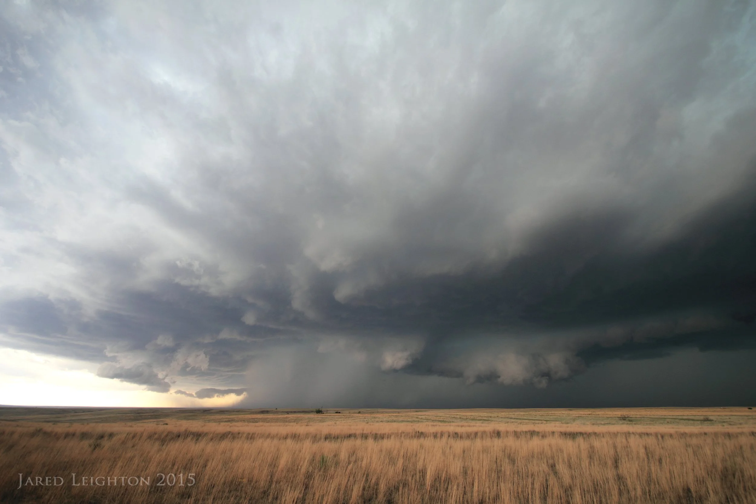
Left Kansas City around 9:00 am intending to chase what I deemed to be a good CAPE/shear environment in southwest Kansas, as a lumbering closed mid level trough spun around the desert southwest. The better moisture was progged to be across the eastern Texas panhandle, but it looked as though there would be enough moisture to come to southwest Kansas to warrant the trip to Liberal. At the very least, if the Kansas target didn't work out the eastern Texas panhandle wasn't too far away.
As the day wore on it became more apparent through observations and HRRR model solutions that the day would not pan out as originally hoped. So the adjustment was made to drive south out of Meade, Kansas to try to get on some cells that were ongoing in the northern Texas panhandle. As I worked my way south each new cell that I targeted diminished as I approached it from the north. Ultimately I made the decision to just target the southernmost cell in the line, which was just west of Pampa, Texas. In fact that cell was dropping large hail on Amarillo, Texas at the time of target.
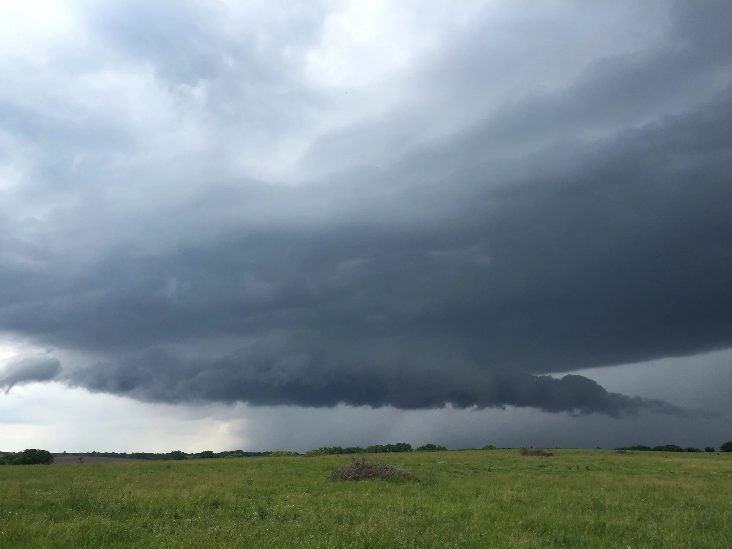
As I dropped into Pampa, I decided that the storm motion would take the storm toward Lefors, Texas. So, without much in the way of road options I opted to go to Lefors and wait for the storm to trek eastward. Between Pampa and Lefors I noticed a cone-shaped lowering under the updraft of the storm. This turned out to be a weak, dusty tornado that formed near the town of Groom, Texas. Since the storm was still 5-10 miles to my southwest I did not get a great look at the tornado, and the wide angle lens was inadequate to take a usable picture of the the tornado. Aside from those issues the hilly terrain caused me to lose sight of the tornado just long enough for it to dissipate before emerging from the hills.
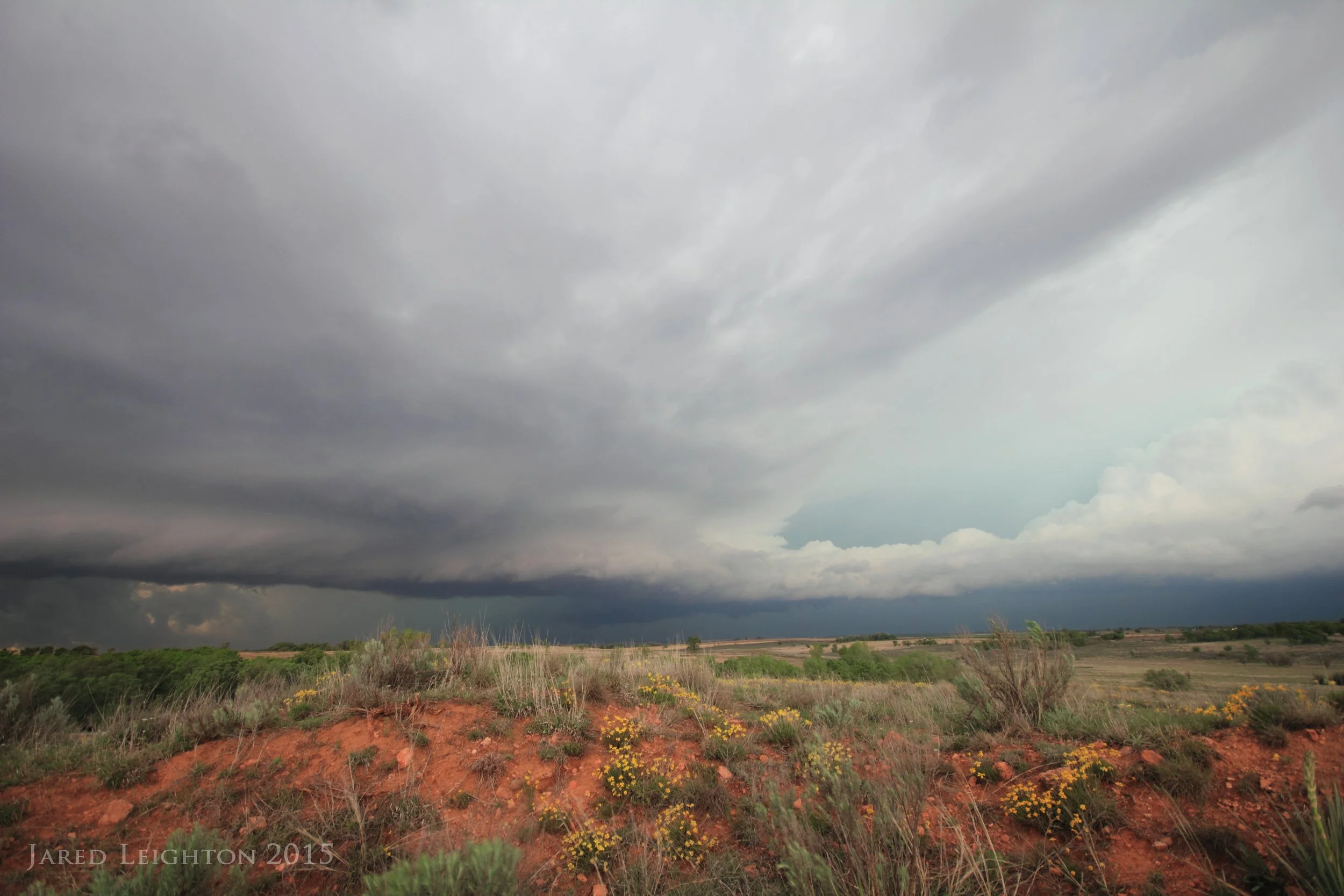
I followed the storm east/northeast until I had to drop into Shamrock to refuel. After refueling I moved north toward Wheeler to get another look at the storm. By this time it had become very HP, and starting to bow out. After getting some good foreground shots between Shamrock and Wheeler, I dropped back to Interstate 40 to begin my long drive home.
On my way home, I noticed a new cell that popped up just south of Sayre, Oklahoma. I watched the updraft billow upward for the better part of 30 minutes as I drove toward it. Not thinking much of the new storm I decided to drive through it to keep on track to get home before 4 am. As I was just emerging from the hail core, my phone delivered a WEA alert for a tornado warning. Confused I opened up my iPad to note that indeed this cell had become tornado-warned. Knowing I was out of the path of the updraft I looked behind me to see if I could see anything in the vicinity of the updraft and low and behold I noticed a tapered lowering resembling a broad funnel cloud. I exited the Interstate just west of Sayre and hit the frontage road heading back to the west. There I set up to take a few shots of the distant tornado as it crossed the interstate. After witnessing its demise and calling in the report, I resumed my long drive back to Kansas City.
Mature supercell, with possible tornado west of Pampa, Texas
Mature supercell between Shamrock, Texas and Wheeler, Texas
Target: Nebraska City, Nebraska
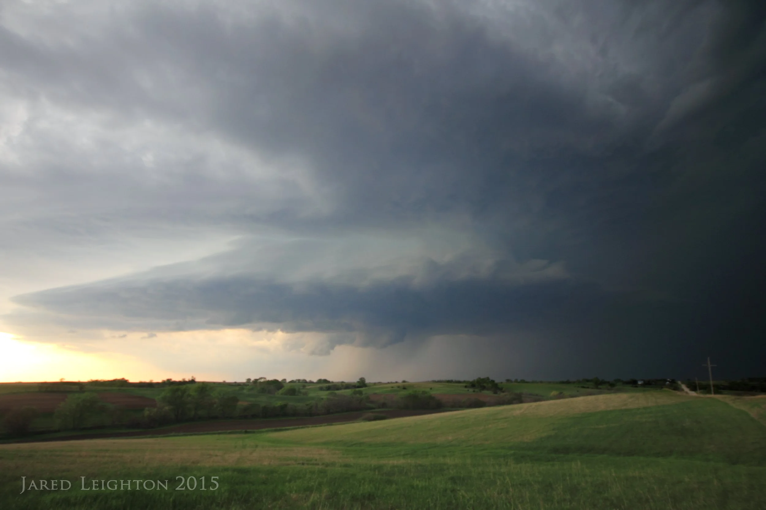
The day started without the intent to chase, but after a brief look at the HRRR in the early afternoon I became intrigued by a modeled supercell expected to initiate near Lincoln, Nebraska, then track east/southeast toward Nebraska City. Seeing as though Nebraska City, is only 2+ hours from my house I decided to give it a try. While sitting in Nebraska City, the first good storm of the day fired up near Milford, Nebraska and was tracking east/northeast. So, I took off toward Lincoln, intending to intercept the storm somewhere near Waverly, Nebraska. Enroute, the storm took a wild right-hand turn and started heading hard south/southeast. So I ended up making my first intercept with the storm just south of Palmyra. Given the storm's hard southeast movement, I continued to drive southward through Douglas and Sterling before reaching Crab Orchard. Thinking perhaps the storm lost it's supercellular characteristics by its more eastward movement I took HWY 136 through Tecumseh and set up between Tecumseh and Johnson, Nebraska, just south of HWY 136. Here I was trying to take lightning photos when a second storm to the west briefly produced a tornado near Firth, Nebraska. The tornado was a long way in the distance, so a good observation was not made, nor are there any photos. As I continued to shoot the westernmost storm, the eastern storm produced a very tight velocity couplet right on top of me. Fortunately, it did not produce a tornado. At that point, with the two tornadic storms merging, I decided to end my day by dropping south toward Sabetha while I still had an opportunity to stay ahead of the congealing convection.
Supercell near Sterling, Nebraska
Target: Lubbock, Texas
Well, I never made it to Texas on this day. The target area was subject to day time destabilization ahead of an advancing dry line. However, along the way to Lubbock, I noticed a rather defined boundary draped across southern Oklahoma. This boundary looked good enough to get any storms that fired up as a result of a passing mid level trough to rotate. After a tornado watch was issued for the Red River Valley, I decided to ditch my target and look at the storms moving northeast out of Texas. A strong storm finally formed within the weak showery activity just southwest of Grandfield, Oklahoma. As the storm moved northeast toward Grandfield it became tornadic and produced a brief tornado just west of Grandfield. Due to the very large amount of rain across the area the side roads were unusable, so in an effort to stay up with the storm on paved roads it got too far out in front.
Several more storms formed south of the Red River, but due to bad road options these storms did not look feasible to catch. So, I bailed on the Red River and wet to my original target near Amarillo. By the time I arrived to the dry line the storms that initially fired up died. After meeting up with Scott Nicholson and SpringWx tours we ended the day in Lubbock to get ready for some storms the next day.
Due to a general negative outlook, I called off the May 20 chase to head home. Along the way I drove through the northern Texas Panhandle and was greeted by a great landscape. I finished the trip at home around midnight.
Supercell near Grandfield, Oklahoma
Target: Limon, Colorado
Left Kansas City around 8:30 am with the intent to meet up with Josh Boustead in Colby, then push west toward Limon, Colorado. Instability on this day was progged to be fairly limited, but the deep layer shear approaching 50 kts made the day enticing. North of the warm front temperatures were in the 40s all day, however just south of the warm front across eastern Colorado temperatures were in the middle 60s to lower 70s. This provided enough of a boundary to get a few storms going in eastern Colorado. Generally, the storms were uninteresting; however, about sunset we decided to follow a strong storm along I-70 eastward toward Burlington. For about 10-20 minutes between Limon and Arriba the storm demonstrated some beautiful supercellular structure with marginally strong rotation. As the storm passed over on it's way east we followed it to Burlington where we eventually let it go.
Supercell near Arriba, Colorado
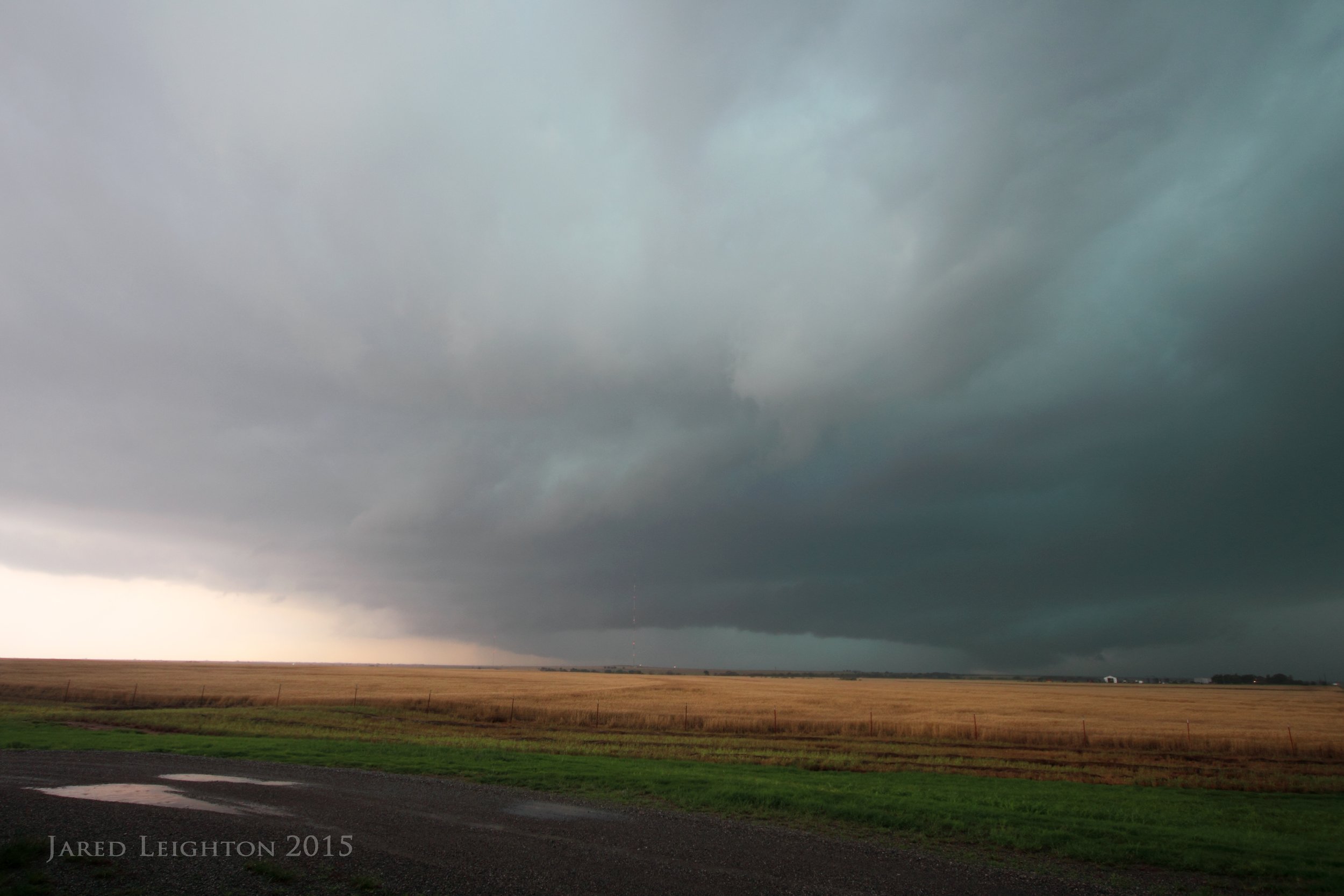
Target: Meade, Kansas
Pretty straight forward chase, with strong instability and nicely curved wind profile over SW Kansas. I refined the target to either far SW Kansas or the NE Texas panhandle. With perhaps a slight bias toward SW Kansas, as well as the Texas panhandle being about 100 miles farther away, I opted to play some storms near Meade, Kansas. Despite the tornadic supercell about 90 miles to my south I found a new updraft over Plains, Kansas. This storm really didn't get over the hump, but for about an hour or so it demonstrated some great barber-pole structure with good visibilty. As this storm gradually weakened, I changed my course to chase after a tornadic supercell near Sublette, but by the time I arrived several mergers had taken place and the storm was no longer tornadic. I ended the chase near Dodge City with some lightning photography among the windmills near Spearville.

Supercell over Meade Golf Course in Meade, Kansas
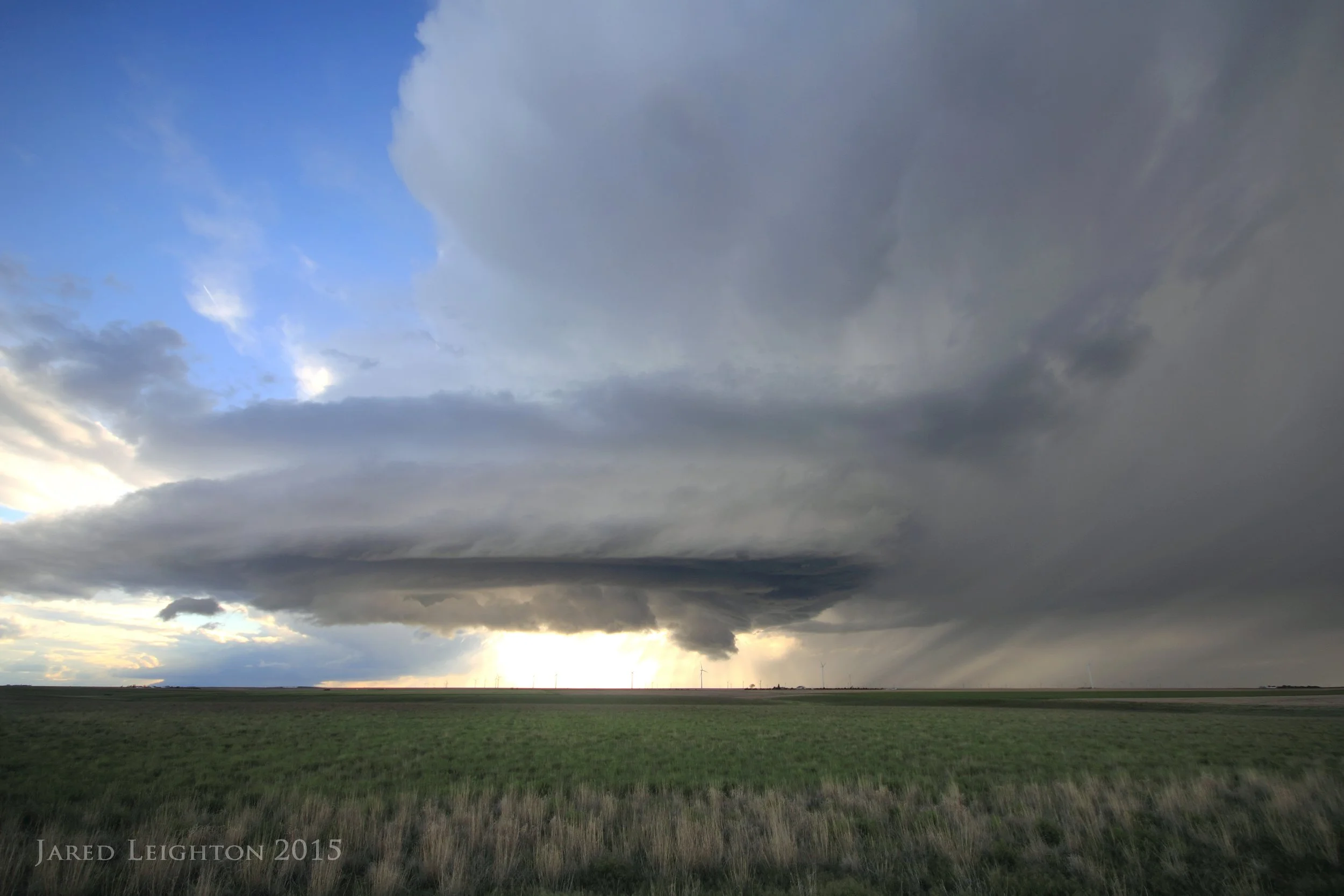
Target: Phillipsburg, Kansas
With a very impressive boundary draped across northern Kansas, expectations this day were for isolated supercell formation somewhere along the E-W boundary. The best parameters spiked near Smith Center, so initially the target was to get to Smith Center. Unfortunately the cap held strong at that location, so Josh Boustead and I migrated west toward Phillipsburg, where the cap continued to hold firm.
After seeing some towers go up to our west and a couple storms go up in SW Nebraska we decided to play the new storm that formed near Atwood, Kansas. Upon reaching the storm it was pretty apparent that it wasn't going to tornado, however the clear skies allowed very good visibility of the main updraft, which was narrow, but very beautiful. It demonstrated a very firm barber-pole appearance, and moved incredibly slowly, allowing for prolonged observation of the storm.
As the storm dissipated we adjusted our position to the storm directly south of Norton, near Dresden, Kansas as the sun went down. This storm, among others nearby, produced one of the most impressive visible lightning displays I can ever remember. I shot the supercell in the dark with visible bolts all around it. As that cell began weakening. I initially headed to Colby, where I was planning to stay overnight. But the visible lightning was too much to pass up. I found a small town with a grain elevator in Rexford, Kansas and shot some lightning, with the elevator and town water tower in the foreground. At that point I decided to call it a day and head to Colby. However a nearby storm became tornado-warned so I took a slight detour to check it out. It ultimately didn't produce much, so I finally finished the day in Colby.

Supercell near Atwood, Kansas
Target: Cope, Colorado
This day started out very dubiously. After spending the night in Colby, Kansas I got a mid morning start toward eastern Colorado. There were several beautiful tornadoes the previous day in eastern Colorado, so that added to the dubious nature of the mid morning start. It's not incredibly common for good storms to form on back to back days in eastern Colorado. I was a bit encouraged when I went out to the car and the temperature was in the lower 70s and the winds were gusting up the hill around 20 mph.
However, as I crossed the Colorado/Kansas border it became incredibly foggy, and the temperature dropped into the lower 60s. Normally this wouldn't be a deterrent, but it was nearly noon, and I was getting concerned about instability recovery by mid afternoon. After sitting in Flagler for a few minutes, I decided that the better parameters were expected later in the day north of Interstate 70. So I went up to Highway 36, then west toward Last Chance, Colorado. Since I was not convinced good storms would form in the better environment I raced west toward the Denver metro area, where a series of storms had formed. They took on brief supercellular structure, but never looked all that good. LCL's were very low, so visibility was not great. At one point near Strasburg, Colorado I witnessed what looked like a very brief elephant trunk tornado. Otherwise these storms were somewhat inconsequential.
At this point I noticed some initiation to my east, where I figured the parameters would get better in the afternoon/evening. So I went back to Byers, then across Highway 36 back toward Last Chance. As I got through Anton, Colorado I noticed the cluster of storms had a couple updrafts that looked supercellular. So I set up on HWY 36 between Anton and Cope. In the field to my south a brief stovepipe tornado formed, then dissipated. However, shortly thereafter, within the same mesocyclone a second (likely a continuation of the first) tornado formed and grew into a very large barrel-shaped tornado about 2 miles south of the highway. After observing it for several minutes it became a bit rain-wrapped, so I drove east on HWY 36 to Cope, Colorado. Here I got my last look at the large cone tornado in the rain as it crossed HWY 36. Another storm to its south formed a tornado south of Joes, Colorado so I decided to run east toward Iberia for that storm. By the time I got to Highway 385 and dropped south the storms generally merged and weakened enough to cause me to consider that area done for the day.
There were a few storms in western Kansas that had become tornado warned, and since I was planning to bust as far east as possible for the next day's set up I decided to get back to I-70 and go east to those storms near Colby. As I was driving east on I-70 I had to drive through a complex of storms near Goodland. Upon emerging from that complex I couldn't find any worthy storms to go after, so I decided to call it a day in Colby.
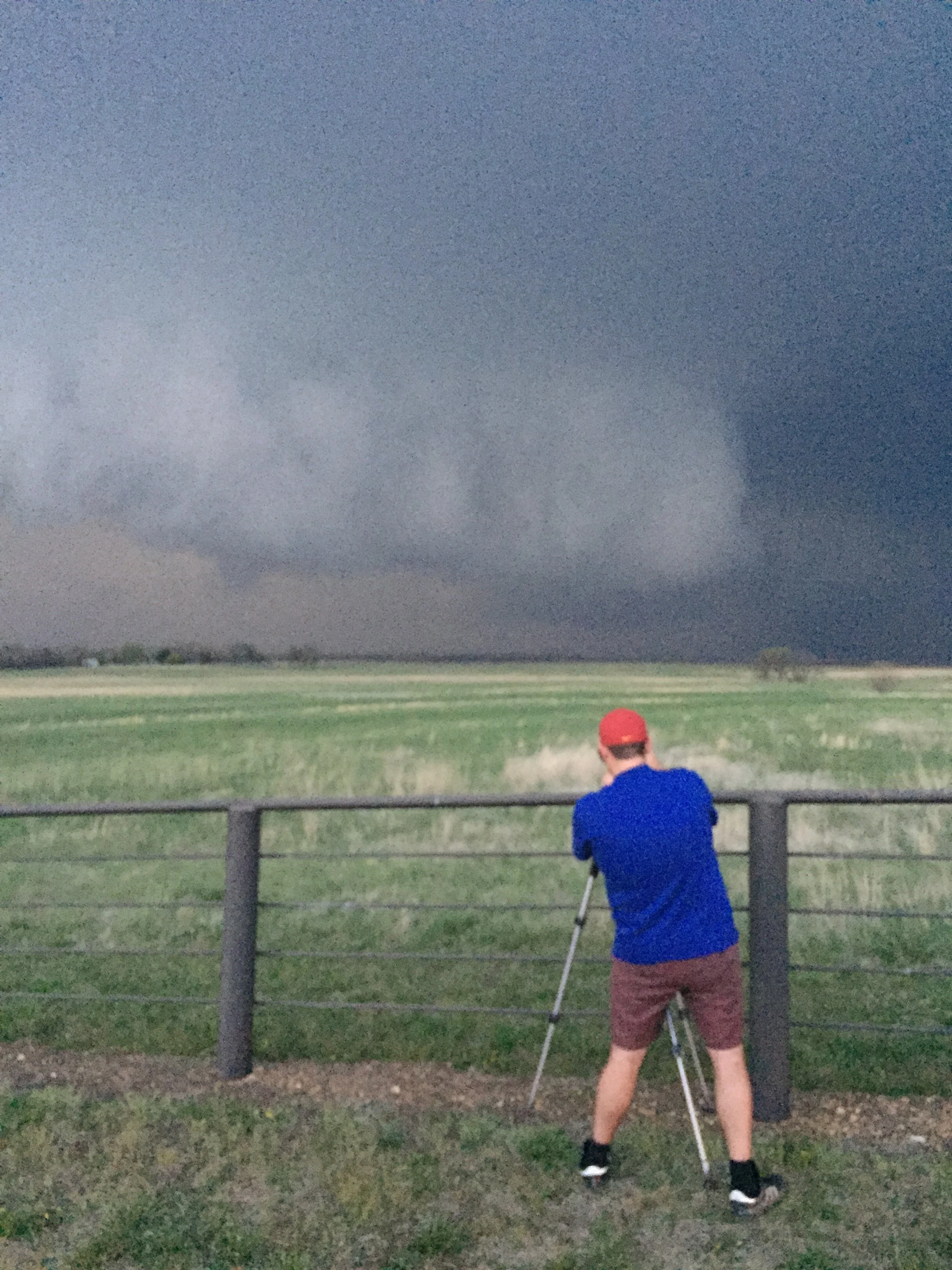
As I was filling my vehicle with gas in Colby, I noticed that the complex I had just driven through had morphed into a supercell near the town of Winona, Kansas, and looked like it had some promise. Since it was only 15 miles to my south I dropped down Highway 25 toward Winona. Once I got to Highway 40 I went west about 2 miles toward the updraft. It was here, just east of Winona that I saw a large tornado just south of the Highway. I obseved that tornado for several minutes before adjusting east to give me some space. At one point it appeared that the storm produced another tornado just north of HWY 40, although it looked to be brief and the lighting prevented me from getting a great look at it. At any rate the main tornado, south of the highway, eventually went through several morphologies and cross Highway 40 just to my west and occluded in a field to my northwest. I was close enough to the storm that when it occluded I could see up into the RFD clear-slot and watch the tornado rope out. A sight to behold!!! I decided I'd had enough for the day so I went north on HWY 25 ahead of the storm and arrived back in Colby.
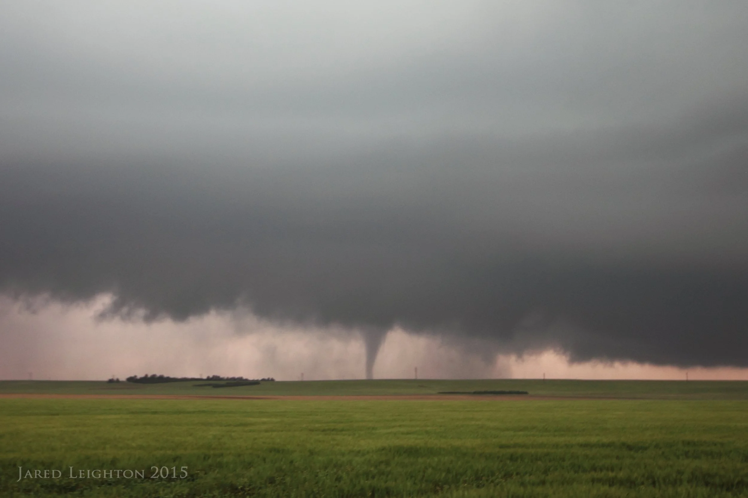
Tornado formed just southwest of Cope, Colorado
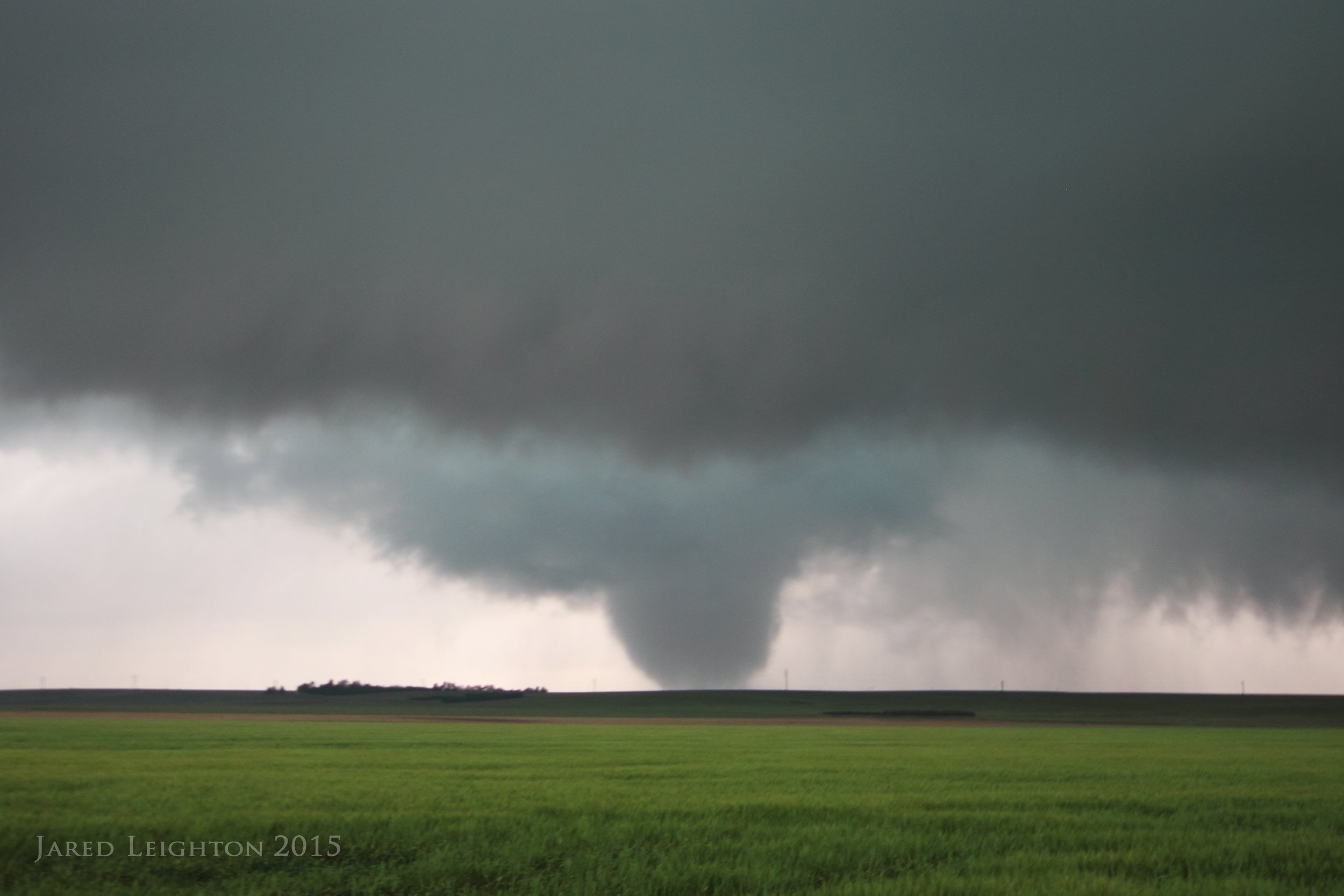
Tornado formed southwest of Cope, Colorado. After going through several morphologies it eventually became a barrel-shaped large tornado
Target: Verdigre, Nebraska
Started the day in Kearney, Nebraska and drove up to far northeast Nebraska. Parameters were good for storms to become tornadic later in the day, so I set up around Bloomfield, Nebraska before going west to Verdigre. Just south of Verdigre I latched onto a supercell that for a period of about 30 minutes looked strong and organized enough to produce a tornado, but ultimately as it drifted toward Creighton, Nebraska it became so involved with other storms that it became a large complex. Hoping the southern edge of the complex would fire up to supercellular status I dropped down to Randolph, but to no avail. The storms generally became a mushy mess, so I ended the day in Norfolk, Nebraska.
Supercell southwest of Verdigre, Nebraska
Target: Tarkio, Missouri
A day which showed some promise in far NW Missouri started with a trip up I-29 toward Rock Port, Missouri. The target was a rather precise location in Atchison County Missouri, with tornadic supercells anticipated. Storms initiated in far SE Nebraska around 3:00 pm and moved into a more favorable environmnt for tornadoes. Met up with Scott Blair in Rock Port, and initially played around with a weak supercell near Tecumseh, Nebraska. After watching the demise of that storm, we blasted east through Auburn, Nebraska and met back up with I-29, just before a storm became supercellular near Craig, Missouri. We followed that storm ENE through Maryville, Missouri before eventually letting it go near Union Star, Missouri. The storm never produced a tornado, but definitely created several tornado look-alikes with the pointed and rising scud.
Supercell near Maryville, Missouri
Target: Lee’s Summit, Missouri
Started the day in my living room, and spent the entire day in the living room before eventually seeing some storm development over the KC Metro area. I was expecting some strong storms in the area, so when the storm in the metro initiated I went to Summit Woods shopping center to take a look at it. After it looked like it was going to tornado near the shopping center I left my position to follow it back into work. While I was travelling on HWY 50 toward the Pleasant Hill NWS office I saw a tornado through the trees. By the time I found a clearing the tornado had dissipated. Heading down HWY 7 toward the office I stopped to take one more photo of the storm and saw the incredible barber pole updraft. Through the night, several supercell treked through the area and produced much damage in the Lee's Summit area.

Tornadic supercell between Lee's Summit and Pleasant Hill, Missouri
Target: Davenport, Iowa
This day had higher expectations that what actually happened. With strong northwest flow aloft and a decent surface cyclone, along with a remnant outflow boundary left over from morning convection, tornadic supercells were anticipated in eastern Iowa and western Illinois. The first storm initiated just northwest of Davenport, Iowa and given the 6000+ J/kg of CAPE and 60 kts of deep shear quickly grew into a supercell. As it matured and moved southeast toward Davenport it merged with another shower that caused it to stagger a bit. So, I got through Davenport and stationed myself just SE of Davenport near Geneseo while it regathered itself. Just as it restablished itself as a strong supercell more downstream showers merged with it, eventually causing it to become too outflow dominant. Dejected, I ended the day near Kewanee, Illinois.

Marginal supercell near Geneseo, Illinois