

Chase 2010
The top of the updraft tower.
Target: Southeast Kansas
Started out the day in Lawrence, KS with Scott Blair and Derek DeRoche. The potential for this day was pretty low, but given the proximity to Lawrence, we decided to venture out and see some low-topped storms. We traveled as far south as Pawhuska, OK before storms finally initiated. Storm motion was NNE at nearly 55 mph, so storms were very difficult to follow. As we struggled to stay with the storms we saw a very brief needle funnel form on the back edge of a low topped storm. As soon as we reached Highway 166 near Cedar Vale we discontinued the chase and followed Highway 59 back to Lawrence.
Target: East Central Kansas
Scott Blair and I left Lawrence, KS around 2:00 pm on April 6th, heading down Highway 75 toward Beto Junction. A line of storms was expected to form across northeast and east central Kansas that afternoon. Storms initiated shortly after 4:00 pm and formed a line which produced marginal severe weather. Near the town of Burlingame, KS we intercepted the strongest updraft and received quarter sized hail and 60 mph winds. Storm motions were too fast to keep up with the storm, so we headed back to Lawrence. By the time the storm reached Lawrence it intensified and caused fairly significant wind damage to the northern portions of town. See the NWS Topeka write-up for more information on that storm.
Target: Liberal, Kansas
We left Lawrence, KS during the mid morning hours on April 22 with the intent to get to Liberal, KS by storm initiation. Storms started up shortly before our arrival to Liberal. With the warm front right on top of us, we decided to wait for the storms currently in the Oklahoma panhandle to move northward and interact with the boundary. When it became evident that the storms would not survive the trip through the panhandle we focused our efforts on a promising storm that was located near Syracuse, KS and was moving NNE toward Scott City, 100 miles north of our location. We traveled north along Highway 83 through Sublette and Garden City. As we got to Garden City we could finally see our storm. Since we were north of the surface warm front the stratus hid any discernable storm features. All along our way from Liberal to Garden City the storm had produced many tornadoes. We could only hope that the storm would continue to produce long enough for us to make the trip to Scott City. We finally caught the storm near the town of Friend, KS. We took Finney Scott Road westward to get a better view of the storm. Here we saw our first and only tornado of the day, as the storm produced a quarter mile wide tornado. Unfortunately due to very low LCLs and subsequent cloud bases the tornado was virtually indiscriminate to the camera, so no photos were taken of the storm nor it's tornado. The tornado became rain-wrapped shortly after it did some minor damage to Scott City, and even though we followed the storm back to Interstate 70 we were unable to see any subsequent tornadoes. Once we intersected Interstate 70 at Wakeeney, KS we called off the chase and headed eastward back to Lawrence.
Target: Wichita, Kansas
This chase started late in the day, as we could not leave Topeka until the mid afternoon; after convection in southeast Kansas and northeast Oklahoma had already initiated. As we cruised southward on the Kansas turnpike we saw on radar that a storm was strengthening on the southwest side of Wichita, KS. This storm soon morphed into a supercell and became tornado-warned. Since it was not likely that we would make it to the southwest side of Wichita before the storm moved into town we decided to sit on the east side of town, just south of El Dorado, and wait for it to emerge from Wichita. While we waited for the storm we listened to radio reports that the ATC tower at Wichita Mid-Continental Airport observed a funnel cloud and subsequent tornado. Since this storm moved into Wichita during the evening commute, there were a lot of people still on the roads. We warned a resident-friend of Wichita of the impending storm and told her to delay her trip home until the storm had passed. Luckily the tornado dissipated before it entered Wichita and the city was spared. As the storm emerged from the city it became outflow dominant and soon the entire storm was gone. With most of the storms moving into SE Missouri and western Arkansas we decided to discontinue the chase and return back to Lawrence.
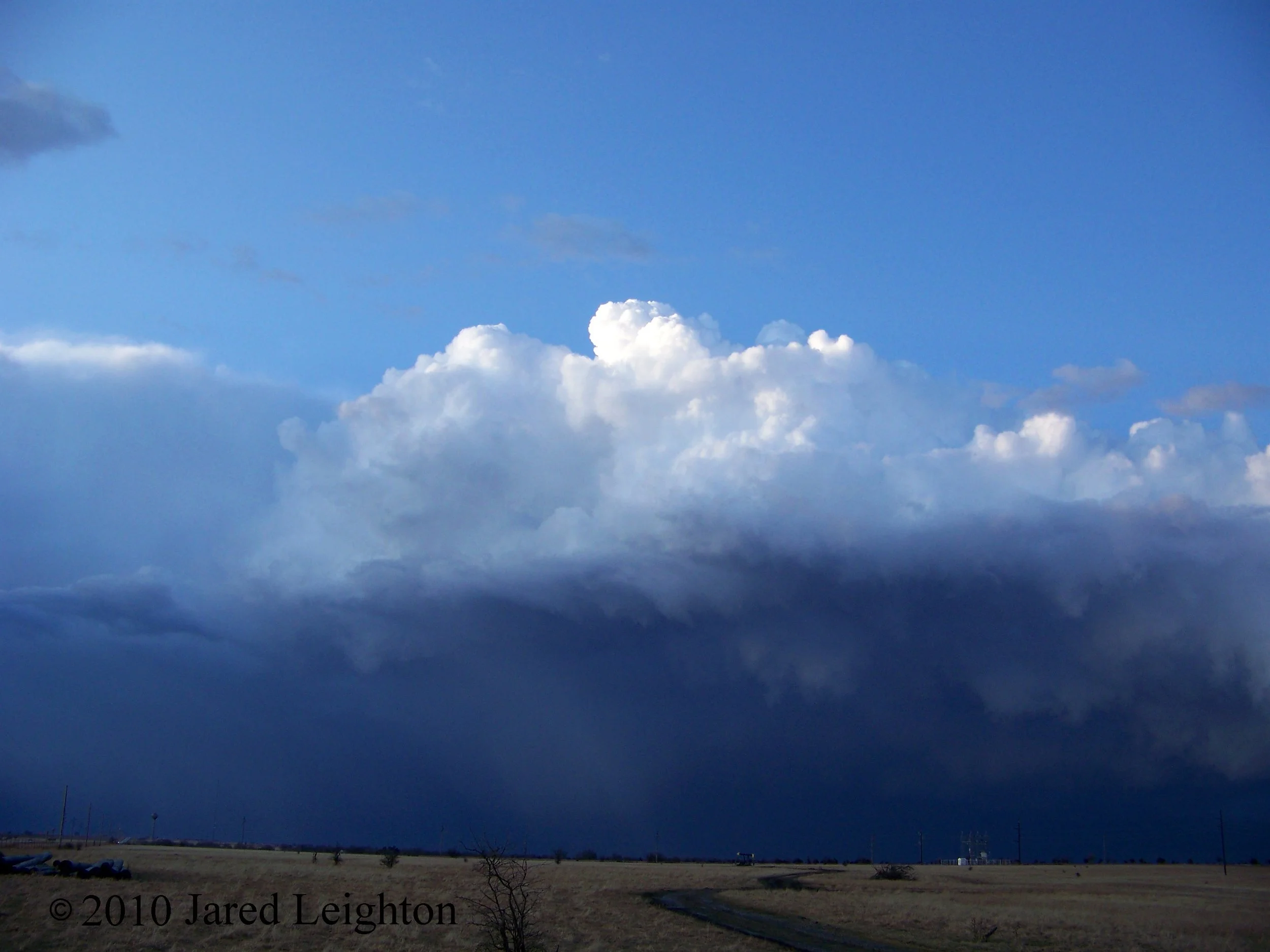
Target: Enid, Oklahoma
Left Topeka, KS around 1 pm and headed south on Interstate 35 toward Oklahoma City. The target was a narrow stretch south of Highway 412 where previous convection laid down an outflow boundary which was going to come in contact with an advancing warm front. Even though a Moderate Risk for severe storms was in place for much of the day, I knew the mid-day High Risk upgrade would bring many of the locals out to chase. What would await me when I finally caught the first cell of the day would utterly shock me.
Still north of the warm front, I was encased in thick low ceiling stratus. Radar indicated that a strong cell a few miles to my south was about to become a supercell, and given the environment would be a prime candidate to produce tornadoes. However, radar also indicated that the storm further to the west, near Watonga was stronger and demonstrated a better reflectivity structure. Due to my position in the cold air, I could not visually see the strength of the storm 10 miles to my south. I opted to go after the "better" storm 60 miles to my southwest. As I journeyed westward, away from the storm, I started hearing radio reports of tornadoes doing damage in Hennessey, and moving toward Stillwater. Still I pressed westward, until finally I reached Highway 33 and caught my first visual of the monster to my west. I was convinced I'd made the right decision. As I went through Kingfisher I noticed a long line of cars going the other direction. I was the only car going west while more than 200 cars passed me going the opposite direction. 40 to 50 of those cars were associated with the Vortex 2 field project. As soon as I was able to turn around, I joined the masses in the exodus eastward ahead of the supercell. When I arrived back in Kingfisher I met up with Josh Boustead. We joined the armada as we drove eastward to stay ahead of the cell. Once the line of cars, now close to 400 vehicles strong, reached Guthrie, a massive traffic jam ensued. The circulation which had already spawned numerous tornadoes between Watonga and Guthrie passed directly over the line of cars as they were all helplessly stopped on Highway 33 near Guthrie. Fortunately there was no tornado at the time. When I finally reached the intersection in Guthrie which was holding up the line of cars, I took a northward turn and headed for home. Josh stayed back and chased one last cell which produced large hail in the OKC metro area. We met up for dinner and remarked about the circus in which we had taken part. This particular chase had and still has me wondering about my future in chasing storms in Oklahoma
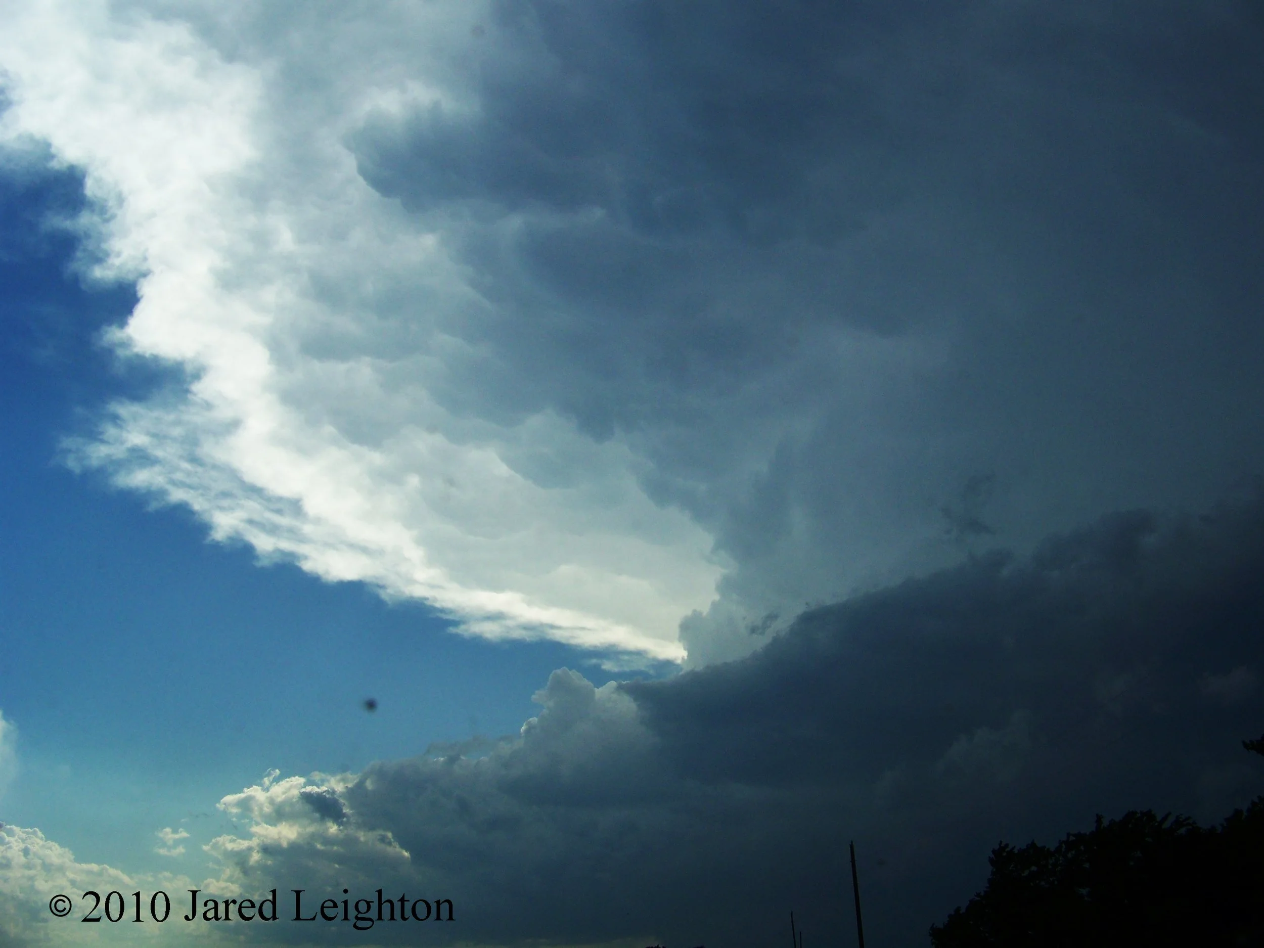
The front flank of the supercell which spawned tornadoes in northwest Oklahoma, along Hwy 33.
Target: Sand Hills, Nebraska
Left Topeka, KS around 1 pm on June 3rd with the initial target of Kearney, NE. As we continued westward on Interstate 80 the target continued to shift westward and northward. Quickly we found ourselves waiting for storm initiation in the Sand Hills of central Nebraska. Storms eventually fired up and pushed eastward. The storms never really showed much potential throughout our journey back to the west southwest toward Grand Island. Other than the nice scenery the Sand Hills had to offer, the trip was largely unexciting. We decided to stop for dinner in Grand Island before our trip back to Lawrence. When we finished with dinner we left the restaurant only to see that the one of the strongest storms morphed into a supercell. We decided to try to meet it a few miles south of Aurora, NE. By the time we reached the offramp to Aurora the storm began to bow out creating some of the most impressive structure I've seen to date. The striated structure of the storm became bowed out and stretched from horizon to horizon. Unfortunately because of the very dim light (8:30 pm), we were unable to get good photos of the structure. As we waited just north of the overpass, we waited for the strong winds to over-take us. There, we experienced 60 mph winds. Once the storm passed, we continued our trek back to Lawrence.
Target: Garnett, Kansas
June 8 was an impromptu chase which resulted in frustration. I started the chase by following a cell into Olathe, KS and letting it go before it quickly went supercellular and nearly spawned a tornado at the NWS Pleasant Hill office. Subsequently I focused my efforts on the storms which were taking on better supercellular characteristics to my west. They were moving west to east through Coffey and Anderson counties. I positioned myself near Richmond, KS and awaited the storms. Unfortunately due to poor visibility I was unable to witness any of the three tornadoes which formed in my vicinity. Once the storms weakened I called off the chase and drove back to Lawrence.
Target: North Central Kansas
This chase started early in the day when I left Lawrence and traveled just south of a vicious thunderstorm which was moving through north central and northeast Kansas. I decided I was not going to chase this storm because the main action was progged to be later in the day in northwest Kansas or southwest Nebraska. This storm was beautiful from my vantage point and even though it was located roughly 30 miles to my north, I was still experiencing inflow winds. Sure enough this storm was responsible for 70 to 80 mph winds across much of north central and northeast Kansas.
I reached my destination of McCook, Nebraska before backtracking slightly to Norton, KS where I met up with Bill Gargan and Dennis Cavanaugh. We stuck together and traveled eastward as storms initiated along Hwy 36 near Phillipsburg. A string of supercells formed along a boundary which had set up along the highway. We chose the eastern cell, which demonstrated the best supercellular characteristics. Although the storm did not produce a tornado we saw nice structure as it entered Concordia. Unfortunately for us, the storms to the west actually produced tornadoes which did damage to farmsteads in Jewell county. As darkness settled in the storms became outflow dominant and weakened. We called off the chase and stayed the night in Hays, KS, and prepared for another chase the following day.
Target: North Central Kansas
Starting from Hays, KS, Bill Gargan, Dennis Cavanaugh, and I drove northwestward to North Platte, Nebraska. Again, we found ourselves too far west and had to back track back to north central Kansas. We positioned ourselves appropriately to intercept any storms which were expected to initiate. By the time the I reached the storms they had bowed out into a strong line segment. I raced out in front of the segment and positioned myself just a few miles southwest of Randall, KS. There I sampled a strong burst of 70 mph wind associated with the leading edge of the bow, which broke numerous 6 to 8 inch trees. Figuring the chase was pretty much over for the day, Bill, Dennis and I left and stayed in Hays, KS for another night. The next day was to be a high plains chase day, so we wanted to get into a good position for the next day's chase.
Target: Yuma, Colorado
This day featured my least favorite chasing experience to date despite the copious amounts of severe and tornado reports. We started the day in Hays, KS and drove westward to Wray, CO. Storms were expected to initiate over the Denver metro area and move eastward across the high plains. My major mistake this day was to try to intercept the storm early in its formation. In doing so, I got behind the storm, and due to the bad road network east of Denver, I found myself woefully behind the storm. It produced a brief weak tornado near Fort Morgan, CO, but because I was so far behind the storm I missed it. I finally caught up to the storm in Wray, CO shortly after it dropped 3+ inch hail on the town, which resulted in many businesses' and cars' windows getting knocked out. As I passed through town, I saw many locals scrambling to get their cars covered in the driving rain. I continued my pursuit of the storm as it quickly moved eastward. Before I could catch it I ended up running into some shallow water running across the highway. After nearly losing my car to the adjacent ditch, I decided to call off the chase and venture home. Due to the heavy rain blocking my route home, I decided to spend one more night at the same motel I'd spent the previous two nights. In the morning I would drive back to Lawrence putting a close to my 2010 chase season.
Target: Topeka, Kansas
September 10 featured a local impromptu chase that didn't take us very far from home. After storms had already initiated near Lawrence we left and headed east toward the Kansas City metro area to intercept some discreet cells in front of the developing line which was located west of Topeka. Having no luck with the small discreet cells we decided to focus our attention to the west and the already warned storms west of Silver Lake, KS. We stopped in the parking lot of KSNT TV on Hwy 24 and waited for the winds to overtake us. We sampled winds up to 70 mph and witnessed very large tree limbs snap in the parking lot. After the storm passed, we left the parking lot and went home.